-
by
Cecilia Levine
Weather
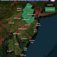
Just one day after a fast-moving storm swept through New Jersey, causing dramatic rescues, a home explosion, and multiple deaths, officials have issued both a Flood Watch and Heat Advisory for the region.The Flood Watch, issued by the National Weather Service in Mount Holly, warns that flash flooding is possible in seven New Jersey counties from Wednesday afternoon, July 16, through ...
-
by
Cecilia Levine
Weather
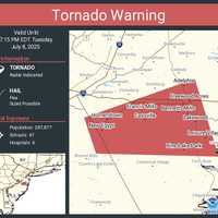
A Severe Thunderstorm Watch is in effect for all 21 counties through 9 p.m., with forecasters warning of damaging wind gusts and heavy downpours. Flash Flood and Heat Advisories also remain in place as of Tuesday afternoon, the National Weather Service said.In Ocean County, a Tornado Warning was issued just before 6:30 p.m. and remains in effect until 7:15 p.m. Tuesday. Radar indicated ...
-

by
Zak Failla
Weather
fThe DMV is baking — again.After four daily high temperature records were either tied or shattered across the region, Tuesday, June 24 is shaping up to be even worse, with heat index values soaring as high as 110 degrees, according to the National Weather Service.National Weather ServiceIn DC, the official high is expected to hit 102 degrees, prompting an Extreme Heat Alert from DC ...
-
by
Cecilia Levine
Weather
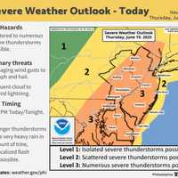
New Jersey is facing a one-two weather punch Thursday, June 19 (Juneteenth): dangerous heat and the threat of severe storms, the National Weather Service warns.High temperatures in the low 90s, paired with tropical humidity, could push the heat index to 100 degrees across much of the state, especially south of I-78, according to the Mount Holly Forecast Office. Conditions are expected ...
-

by
Cecilia Levine
National Interest
A pair of rain storms with heavy downpours with days of intense heat in between are on forecasters' radars for the end of July and the beginning of August.The first round of storms is expected Tuesday evening, July 30, beginning between 8 and 9 p.m. and lasting through early Wednesday morning, July 31, the National Weather Service says. Downpours and localized flooding are both ...
-

by
Joe Lombardi
National Interest
A massive system stretching from the Midwest to the East will bring separate rounds of severe thunderstorms to the region amid high heat and humidity.According to the National Weather Service, the primary threats are locally damaging wind gusts that can down trees and power lines, along with heavy rainfall. A few tornadoes are also possible, along with small hail.The first image above ...
-

by
Joe Lombardi
Breaking News
Gov. Kathy Hochul is warnig New Yorkers that severe heat and high humidity will pose a significant health risk from Monday, July 15, through Wednesday, July 17.Temperatures during that stretch are likely to bring dangerous heat indexes between 95 and 104 degrees across the entire state. New York City, Long Island, the Hudson Valley, Mohawk Valley, and Southern Tier, also have a marginal ...
-

by
Joe Lombardi
National Interest
Numerous clusters of severe thunderstorms, heavy rainfall, and possible isolated tornadoes fueled by the remnants of Beryl are headed to the Northeast.Beryl, which made landfall along the Texas coast as a Category 1 hurricane on Monday, July 8, will move into upstate New York and northern New England on Wednesday, July 10, starting late in the afternoon and continuing overnight.The most ...
-

by
Zak Failla
Weather
The stifling heat in the DMV on Wednesday could turn into possibly strong or severe storms throughout parts of the region.Temperatures are expected to hover in the 90s throughout the afternoon on June 26 with thunderstorms developing later in the day, with potentially damaging winds that could impact residents in DC, Maryland, and Virginia.Keep an eye on upcoming forecasts for possible ...
-
by
Zak Failla
Weather
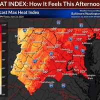
With temperatures pushing toward 100 degrees on Sunday afternoon, several airports in the DMV region have reported new highs, according to the National Weather Service.A Heat Advisory was issued on June 23 with heat index values up to 107 degrees expected in the region, according to forecasters, with "hot temperatures and high humidity (that) may cause heat illness to occur." "Drink ...
-

by
Cecilia Levine
Breaking News
Thousands of New Jersey residents were without power as temperatures spiked and storms swept through on Saturday, June 22.In Rutherford, a "quick but powerful" storm took down five trees including 14 significant limbs and 13 power lines, Police Chief John Russo said.One family was displaced due to a tree impacting their home and most of the 3,500 residents that PSE&G said lost power ...
-

by
Kathy Reakes
Your Community
As temperatures soar across Connecticut on the first day of Summer, smart business owners across the state are offering free items to cool off, including bottled water and vanilla milkshakes.According to the National Weather Service, the heat index is expected to reach 101 degrees on Thursday, June 20, in Hartford County, while other areas of the state will bake with temperatures in the ...
-

by
Joe Lombardi
Weather
A days-long stretch of hot and humid weather will be followed by separate rounds of showers and thunderstorms that will lead to a change in the weather pattern.According to AccuWeather Senior Meteorologist Heather Zehr: "Temperatures early this week are topping out 10-15 degrees above normal from interior New England down through the mid-Atlantic, while coastal areas in New England ...
-

by
Zak Failla
Weather
The dog days of summer have come for the DMV region. Temperatures are expected to approach 90 degrees throughout the area on Thursday, July 6, with heavy humidity that makes it feel closer to 100 degrees, according to the National Weather Service.Another hot day ahead with temperatures in the upper 80s & low 90s. Add in the humidity, & the heat index will make it feel like the ...
-

by
Joe Lombardi
Weather
As dangerously hot summer conditions persist in the region, there will be multiple chances for thunderstorms during an unsettled stretch of weather that will last through the weekend.Storms will be widespread on Friday, Aug. 5, and linger into Saturday, Aug. 6, with areas in dark green in the first two images above seeing the heaviest rainfall.Heat index values (the combination of the ...
-

by
Joe Lombardi
Weather
Separate rounds of thunderstorms will bring drenching downpours to the region, marking the start of an unsettled weather pattern that will linger into next week.Heat index values (the combination of the temperature and humidity) between 95 to 105 degrees are expected on Thursday, Aug. 4, and between 95 to 100 on Friday, Aug. 5, according to the National Weather Service.Thursday will be ...
-

by
Annie DeVoe
Breaking News
A firefighter was injured after a residential fire erupted in Baltimore this morning, authorities say.The firefighter was assisting in containing the fire in the two-story home in the 1500 block of Latrobe Park that started around noon, Monday, July 25, according to Baltimore Fire officials.The firefighter is being treated for their injuries.Officials noted that the heat index at the ...
-

by
Joe Lombardi
Weather
The combination of the temperature and humidity of the air is officially known as the heat index.But the informal label -- called the Misery Index - will be a lot more appropriate on Monday, July 20.Steamy, unhealthy, dangerously hot conditions will reach their heat on Monday as that Misery Index which will soar between 110 to 115 degrees in some parts of the region. (See image above.)A ...
-

by
Joe Lombardi
Weather
It will be hazy, hot and humid with several chances for thunderstorms this week.Sunday, July 5 will see skies clear after morning clouds, with the high temperature around 90 degrees.It will be sunny on Monday, July 6 with the high temperature again around 90 degrees.There will be a 50-50 chance for scattered showers and thunderstorms after 1 p.m. Monday through the evening.Tuesday, July ...
-
by
Joe Lombardi
Weather
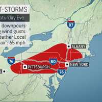
Severe thunderstorms with damaging winds are expected across the region this weekend.The storms will be scattered and in the afternoon and evening on Saturday, June 27. The most likely time frame for storms is between 3 p.m. and 9 p.m. Saturday. Damaging winds that could cause power outages are the biggest threat, the National Weather Service said in a Hazardous Weather Statement issued ...
-

by
Joe Lombardi
Weather
There will be a big change in the weather pattern following another sunny and warm day.Friday, June 26 will be mostly sunny and a bit more humid with the high temperature in the mid 80s.Then comes the big change as a warm front approaches the area overnight.Possible strong to severe thunderstorms are possible on Saturday, June 27 both in the afternoon into the evening across the region. ...
-

by
Joe Lombardi
Weather
Here comes the hottest stretch this summer, and the first heat wave of 2019.Extreme heat and humidity starting on Friday, July 19 will last through the weekend.An Excessive Heat Warning is in effect from noon Friday until 8 p.m. Sunday, July 21.Friday's high temperature will be right around 90 degrees under mostly sunny skies. The heat index (the combination of heat and humidity) will ...
-

by
Joe Lombardi
Weather
Get set for a new round of storms. But this time, it will bring relief from the heat as a cold front arrives in the area.The front will be accompanied by thunderstorms Saturday afternoon and evening.Some of the storms will be severe and produce locally heavy rain, gusty winds, lightning and localized flooding.The storms will develop in the early afternoon before sweeping through the ...
-

by
Joe Lombardi
Weather
The heat wave hits Day 4 a day before the Fourth of July, but there's a new wrinkle in Tuesday's forecast.Namely, thunderstorms.Excessive Heat Warnings and Heat Advisories continue through 9 p.m. Tuesday for much of the region as heat index values are again expected to rise to between 99 and 105 degrees for inland areas.Morning fog will lift, followed by hazy sunshine and then ...
-

by
Joe Lombardi
Weather
Related story: Early Dismissals Announced As Schools Prepare For Monday's Extreme HeatWith record-breaking temperatures possible, the National Weather Service has issued a Heat Advisory for Monday.The advisory is in effect from 11 a.m. until 8 p.m. Monday.The heat index is expected to be around the 100-degree mark with a daytime high in the low-90s.A Heat Advisory is issued when the ...


